Books & Maps related to Hamilton County, Lyon Township, or town of Jewell Junction
Books
|
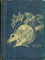
<- - - - - Click book to see some pages
of Iowa Official Register
A Biographical Record of Hamilton County Iowa
Courses
of Study for the Jewell Public Schools
<- - - - - Click book to see some pages
of Lee's 1912 History of Hamilton County
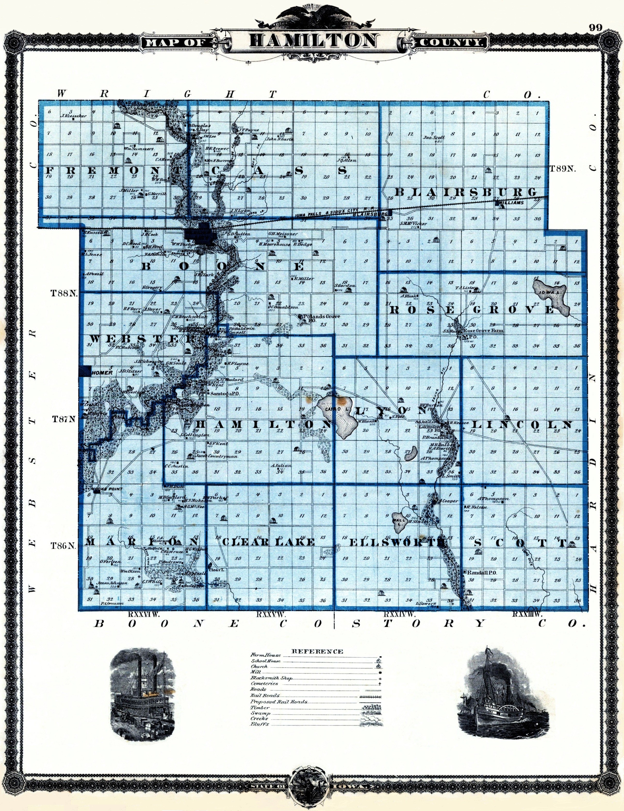
Standard Atlas of Hamilton County, Iowa
<- - - - - Click book to see one story from
Early Days in Hamilton County, Then and Now
Rand, McNally & Co. Universal Atlas of the World
Reader's Digest Great Word Atlas - First Edition
Atlas of Story County, Iowa
<- - - - - Click book to see the pages of
Hamilton
County Historical Society The Story of our County
The History of Hamilton County, Iowa
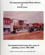
<- - - - Click to see a few pages of
The Quasquicentennial Photo History of Jewell, Iowa
|
We had More Books in our Collection
You may click to enlarge for easier reading.

1836


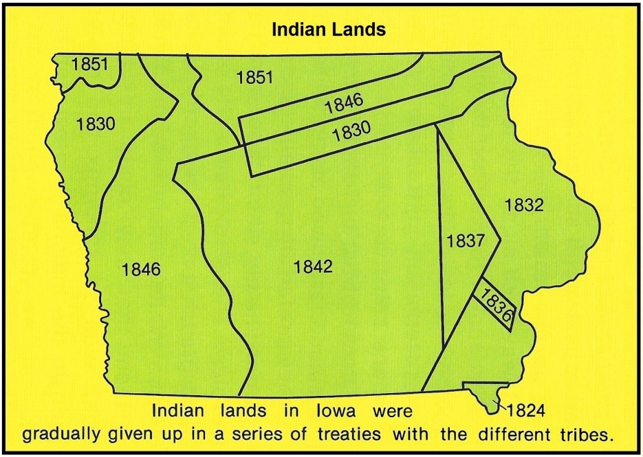
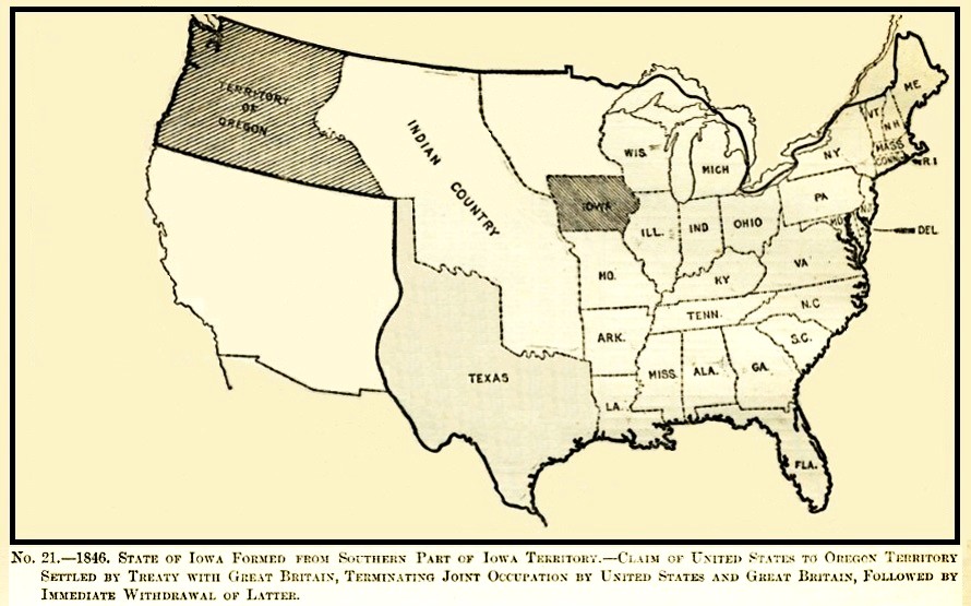
December 27, 1846 - Iowa Becomes the 29th State
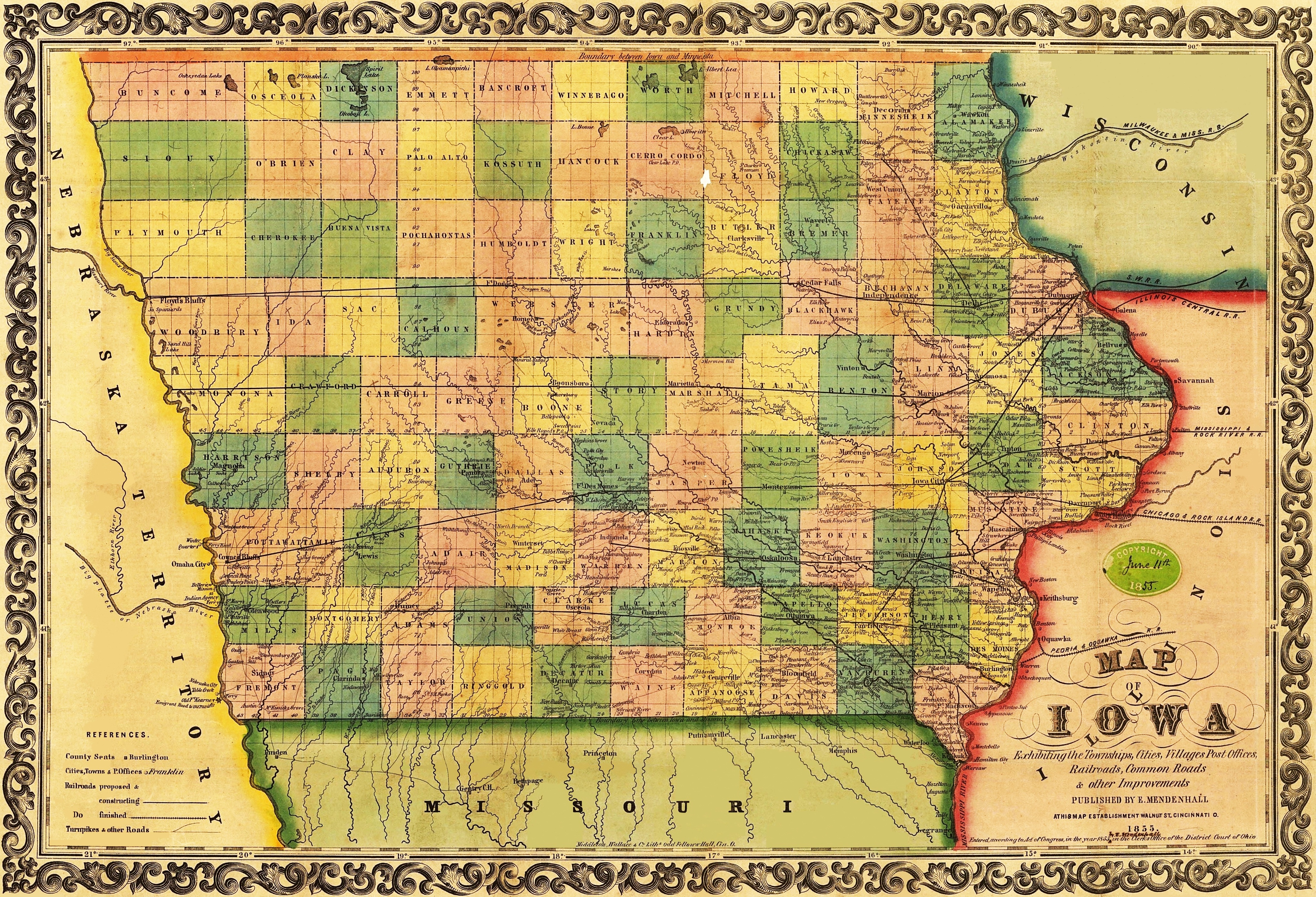
1855

Hamilton County map showing old
settlements in each township.
(This historic map has been updated to show the locations of today's
towns.)

(You may click to see an enlargement.)
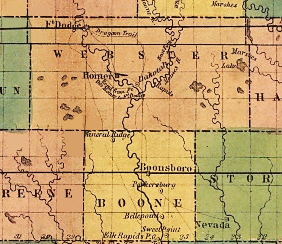
1855 Mendenhall Railroad Map
below is the portion of the above 1855 Mendenhall Map
which shows Webster County.
(one year later the east half would known as Hamilton
County):
Hamilton County portion of the
Johnson & Browning 1862 map of Iowa
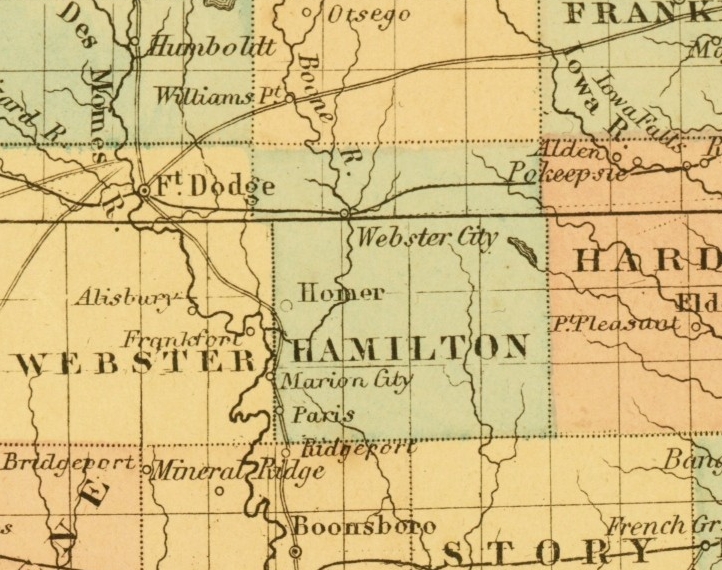
Only Webster City and Homer are recognised from today's viewpoint of this 1862 map.
Portion of the 1864 Johnson Map of Iowa and Nebraska
another 1864 Map
(You may click to see this same map showing 16 counties.)
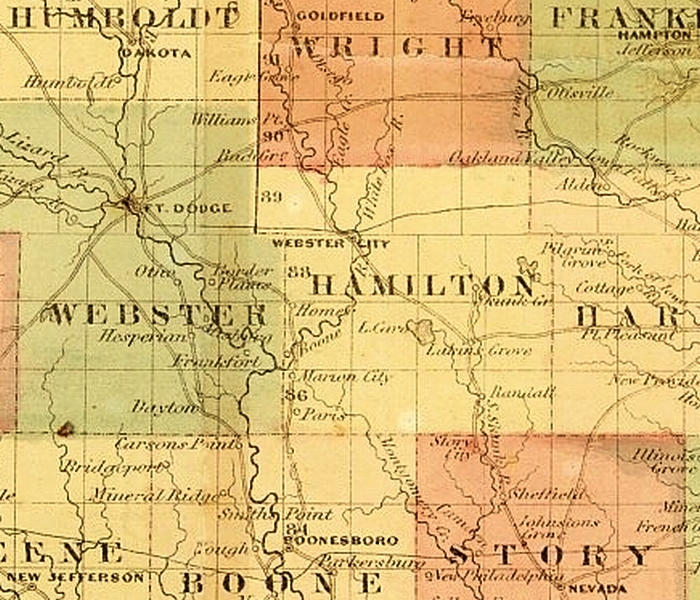
The 1875 Andreas Atlas Map of Hamilton County
(Click to view a larger size version of this map.)
The 1878 Colton Map of Iowa
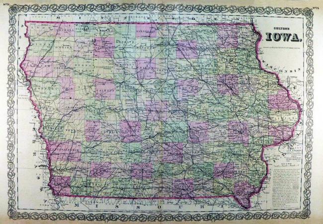
below is the portion of the 1878 Colton Map which includes Hamilton County:
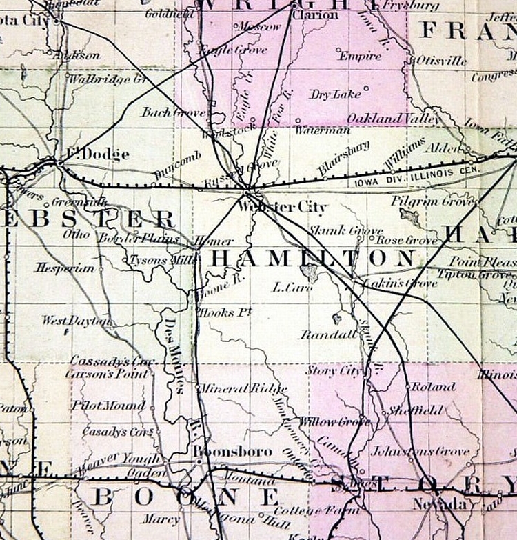
1878 Map
1881 Railroad Map of Iowa
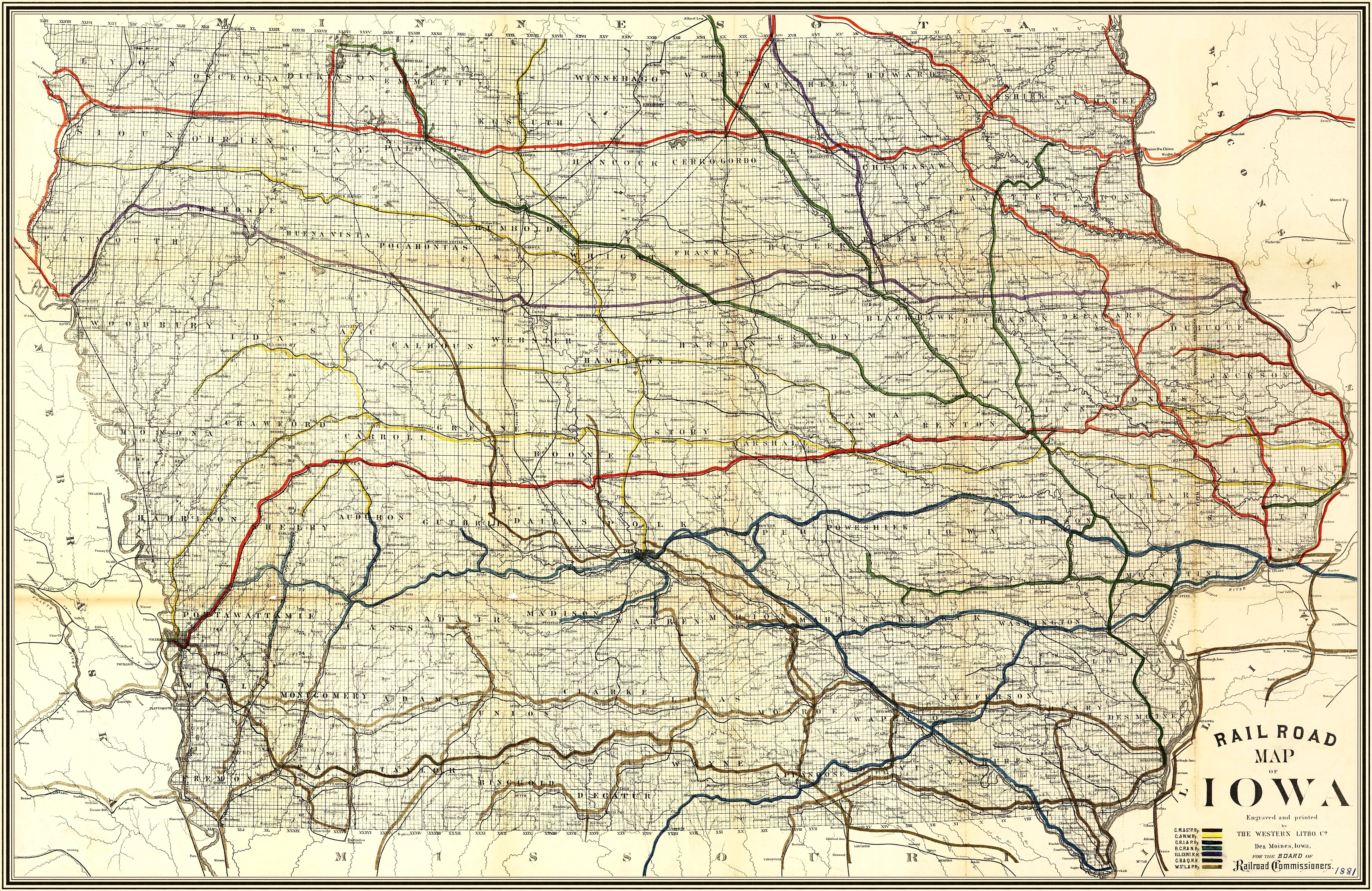
(You may click to enlarge this map.)
The areas around Hamilton County from this 1881 Railroad Map is seen below.
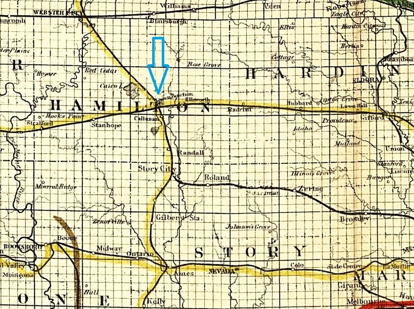
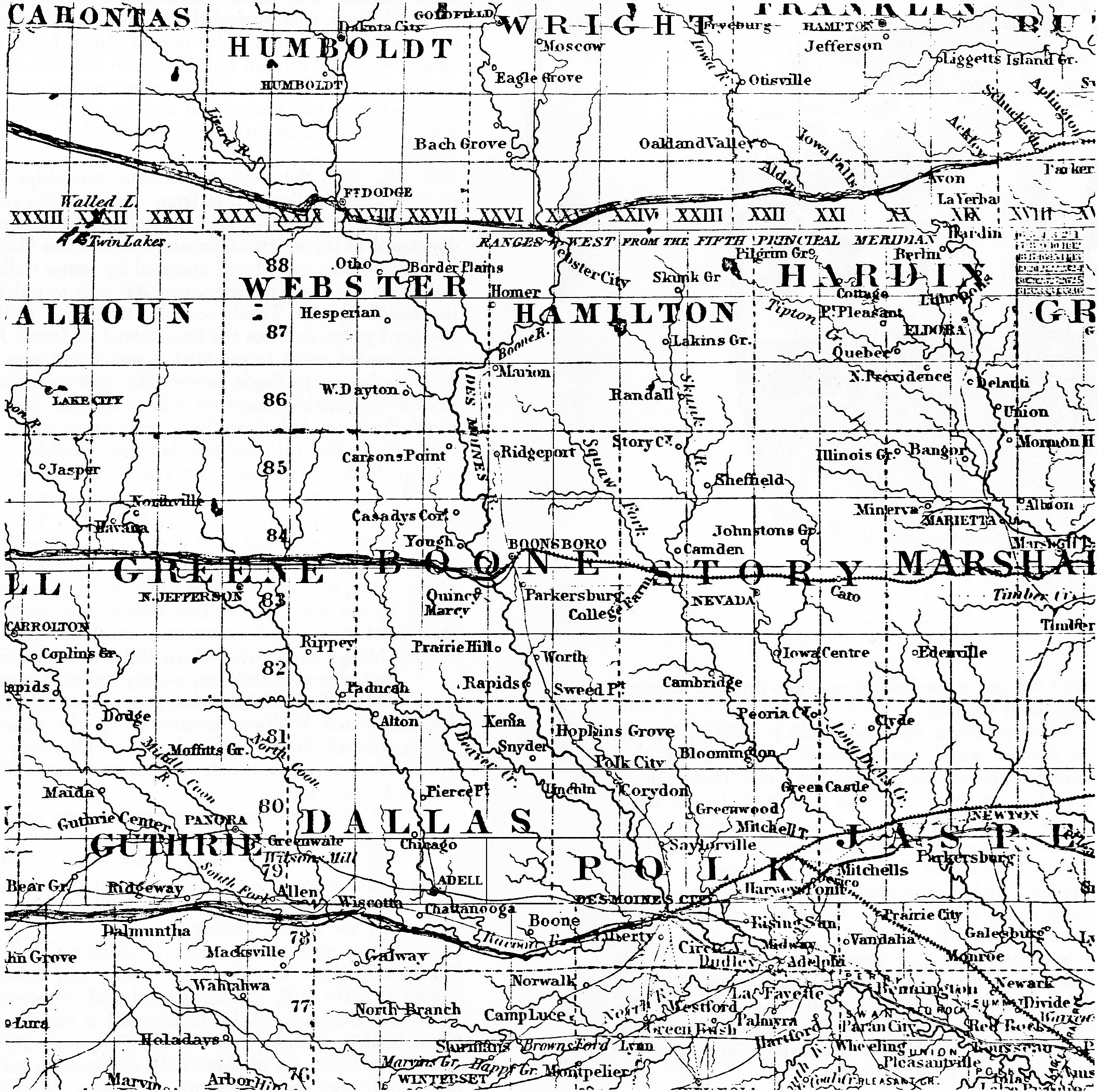
1891 Railroad Map of Iowa
You may click to view a larger version of the map seen above. The Hamilton County portion is seen below.
1902 Rand McNally Railroad Map
You may click to view a larger version of the map seen above. The Hamilton County portion is seen below.
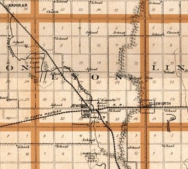
(You may click this 1904 map to see an enlargement.)
or below you may view the inset which includes the town of Jewell in 1904.
1912 map of Jewell

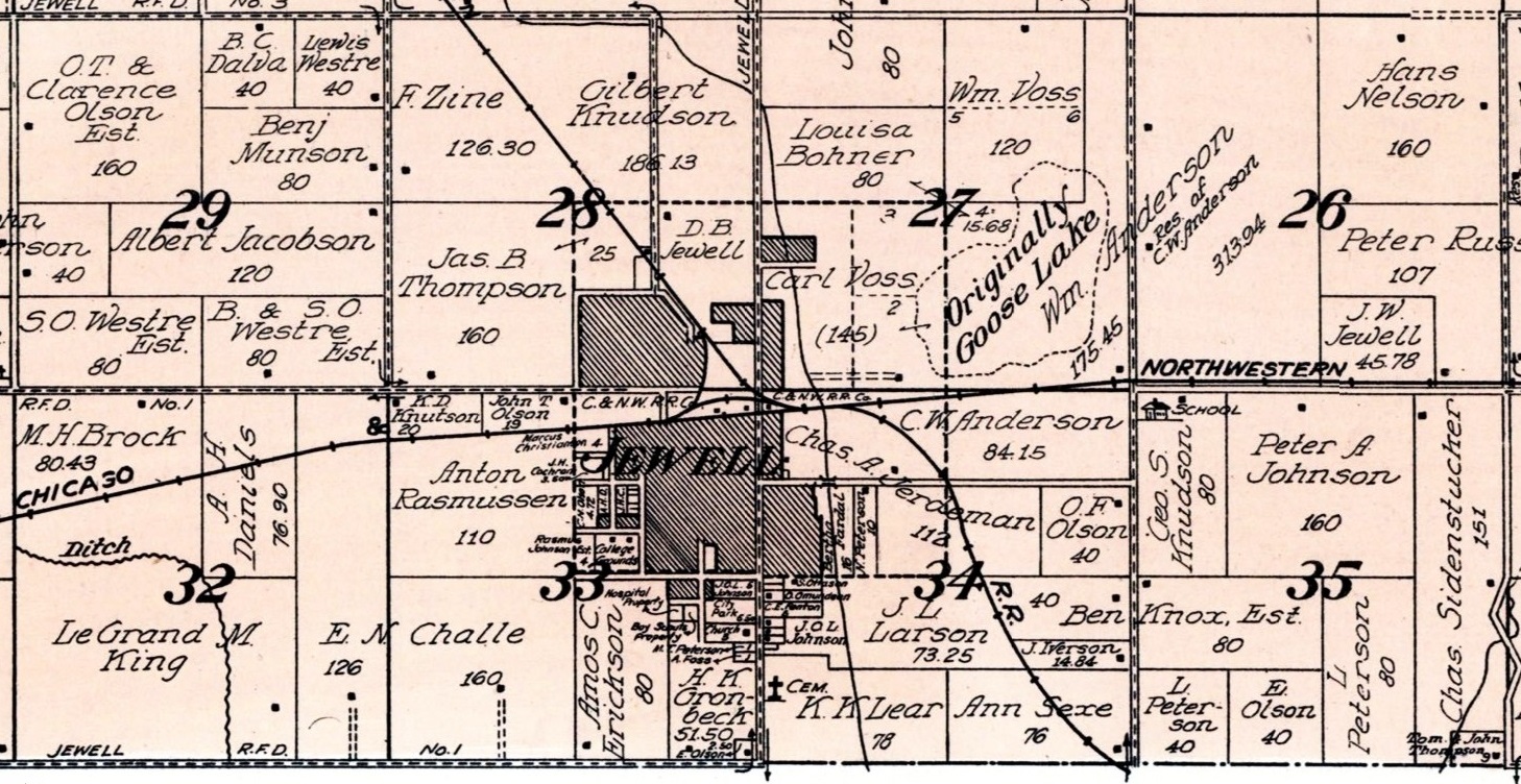
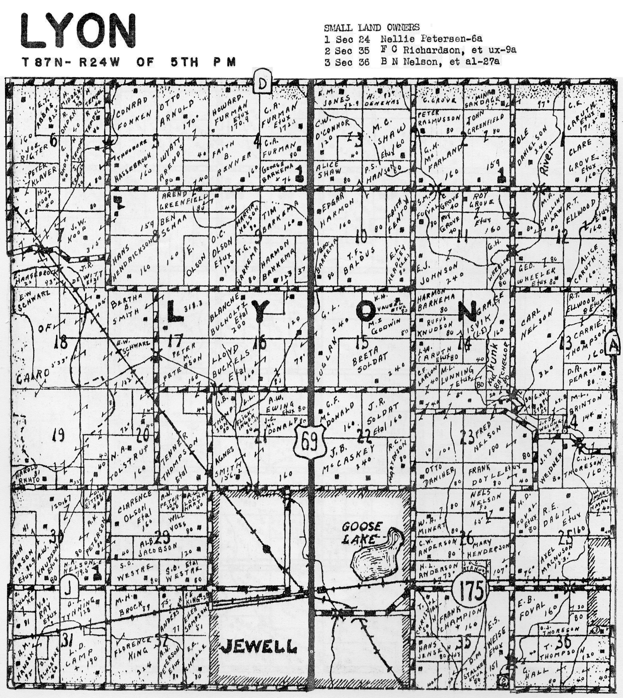
The Jewell portion of the 1918 Plat Map of Lyon
Township
(You may click to see an enlargement for easier reading of names.
The entire map is included on the next page of maps.)
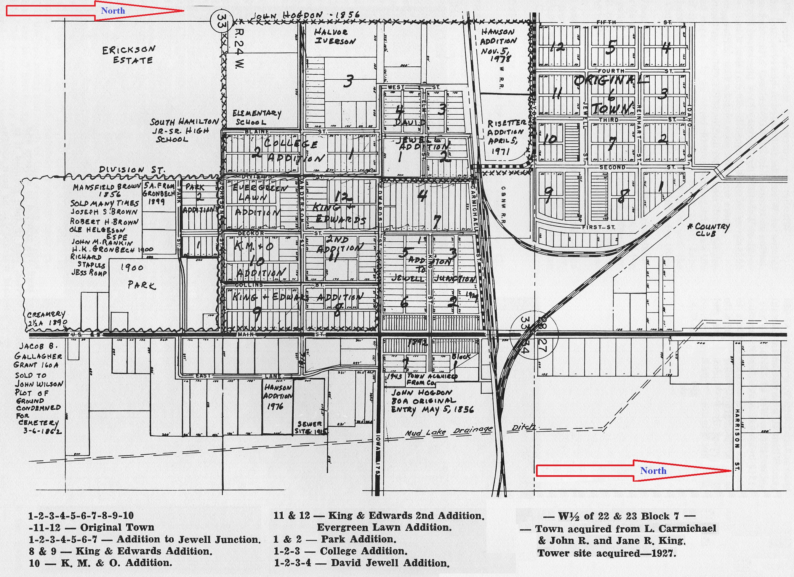
You may click to enlarge this map which shows the early original
town of Jewell plus the later additions.
The meaning of the numbers is explained at the bottom of the map.
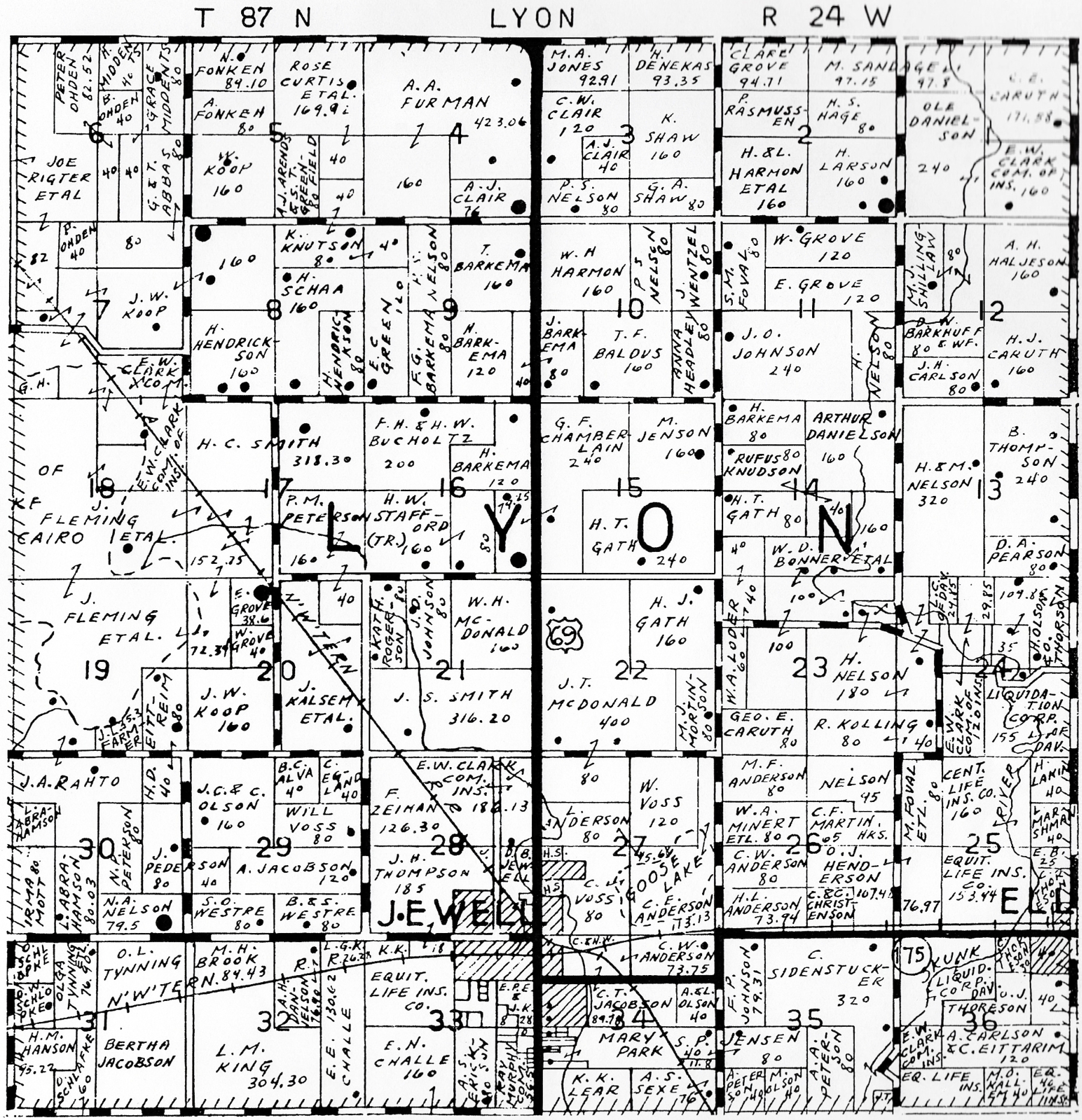
1930 Plat Map of Lyon Township
(You may click to see an enlargement.)
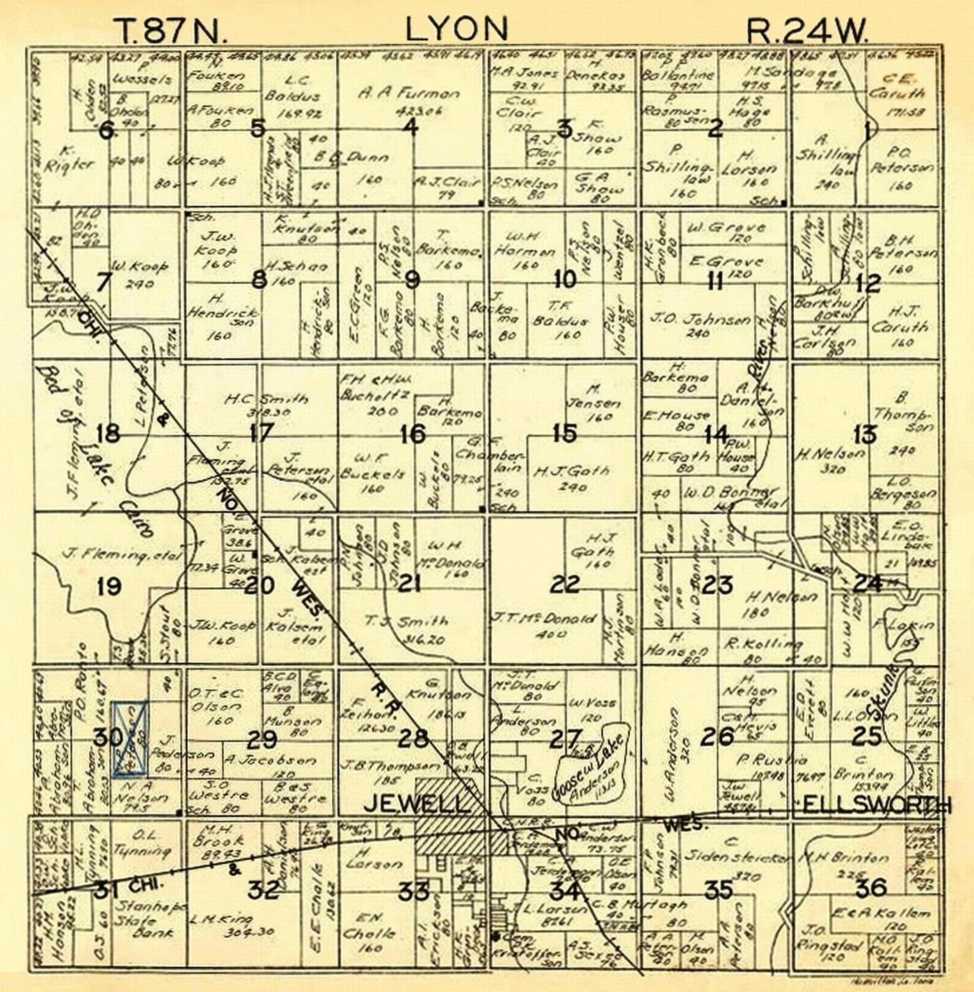
1930 Map
1957 Map (You may click to enlarge.)
More Plat Maps may be found on Page 2 and 3.
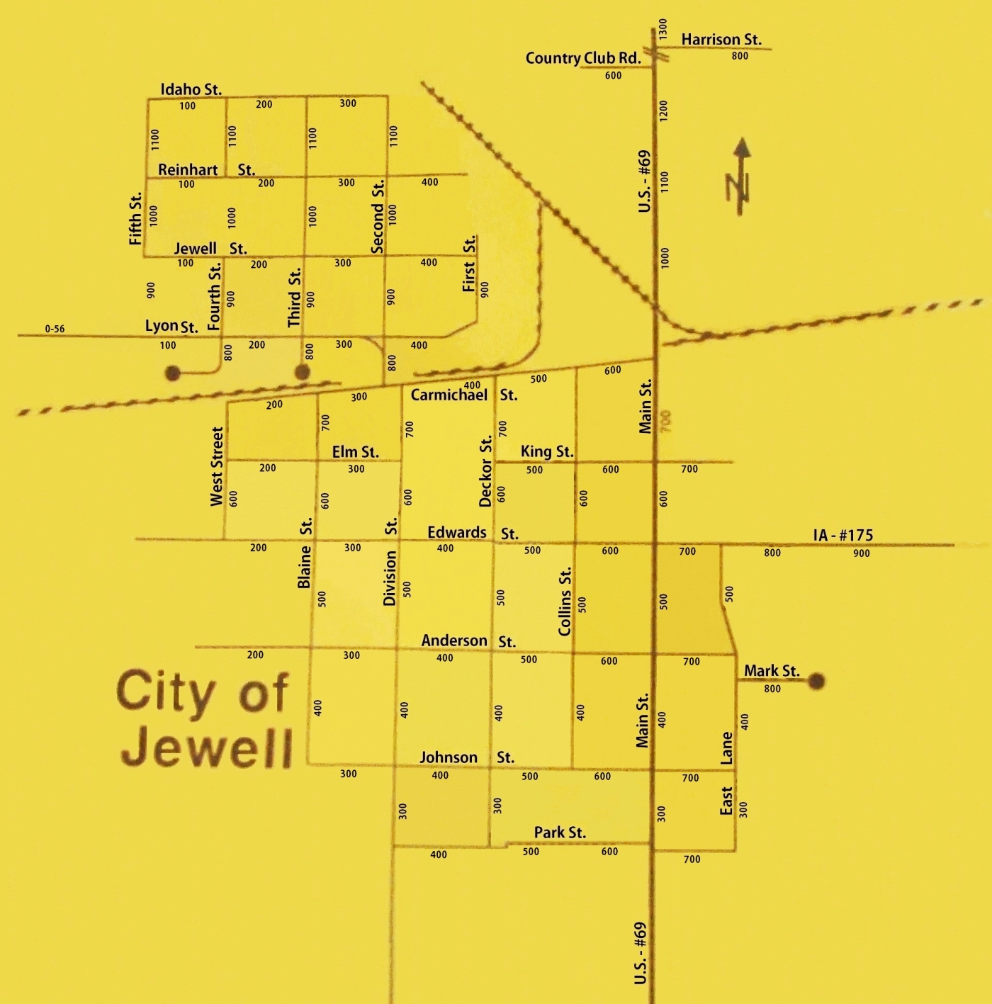
1992 Map of Jewell
View Plat Maps of Hamilton County Townships on the next two pages.
Page 2 - 1918
Page 3
-
(Township Plat Maps of 1930, 1937, 1957, and 1974)