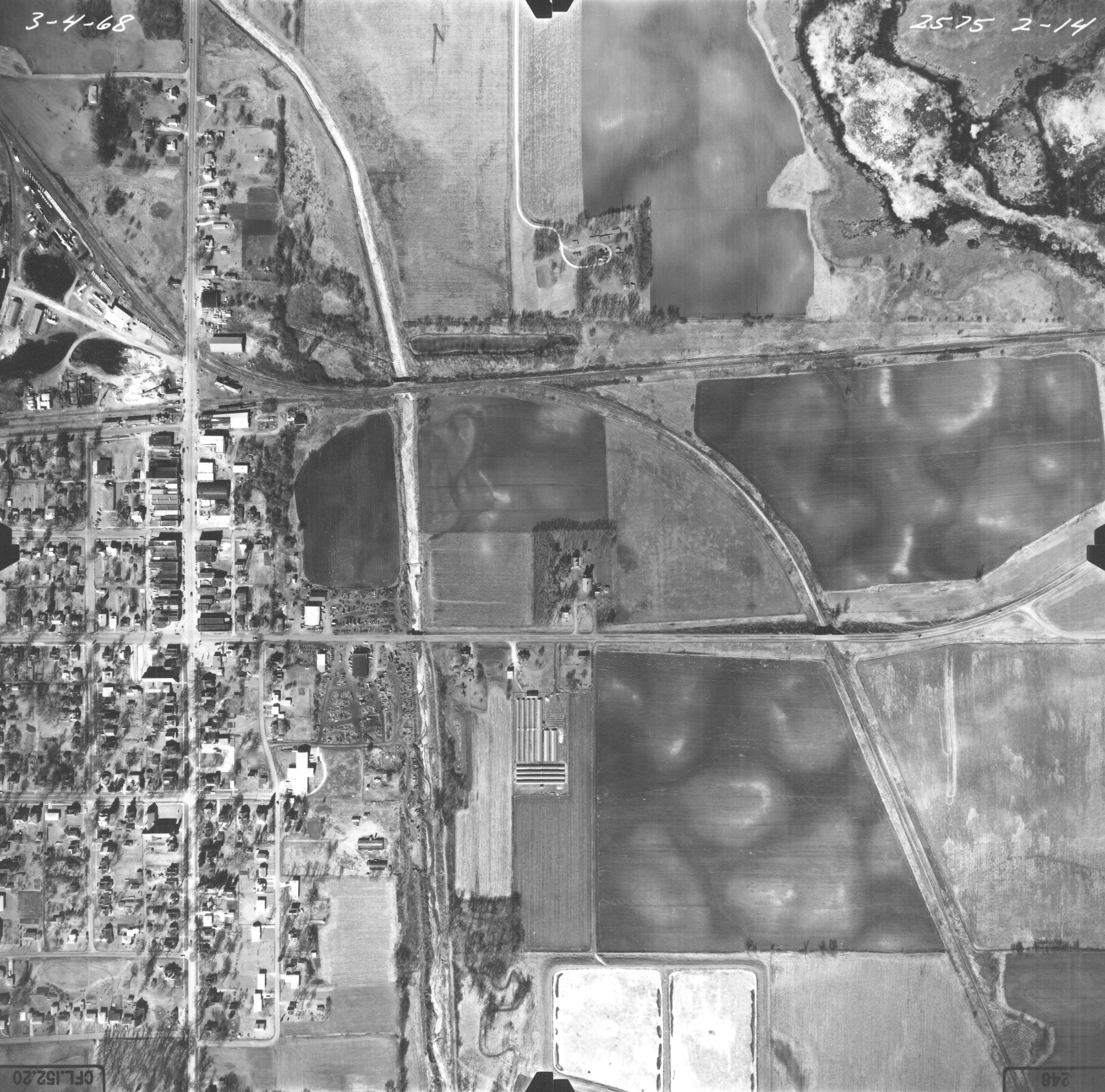
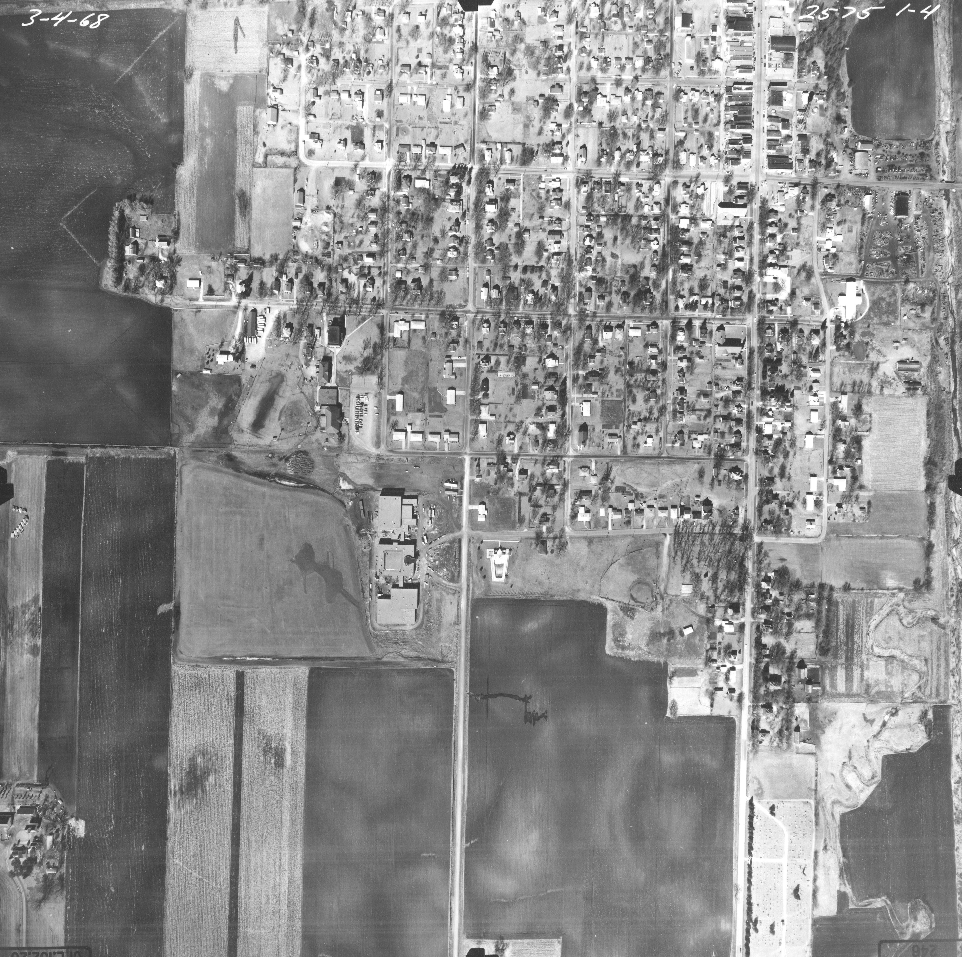
These aerial photos show Jewell and the surrounding rural area in March of 1968.
The black marks appearing at the outside edges of these
aerial photos probably relate to the clamps
which held the negatives during the development process.
Three of these aerial photos
show the Jewell Chicago & Northwestern Depot and the surrounding
railroad area.
These first two images show US Highway 69 and the
area west.

(You may click to enlarge these images.)
The image above shows the two railroad tracks and the area north (original Jewell Junction).
(You may click to enlarge these images.)
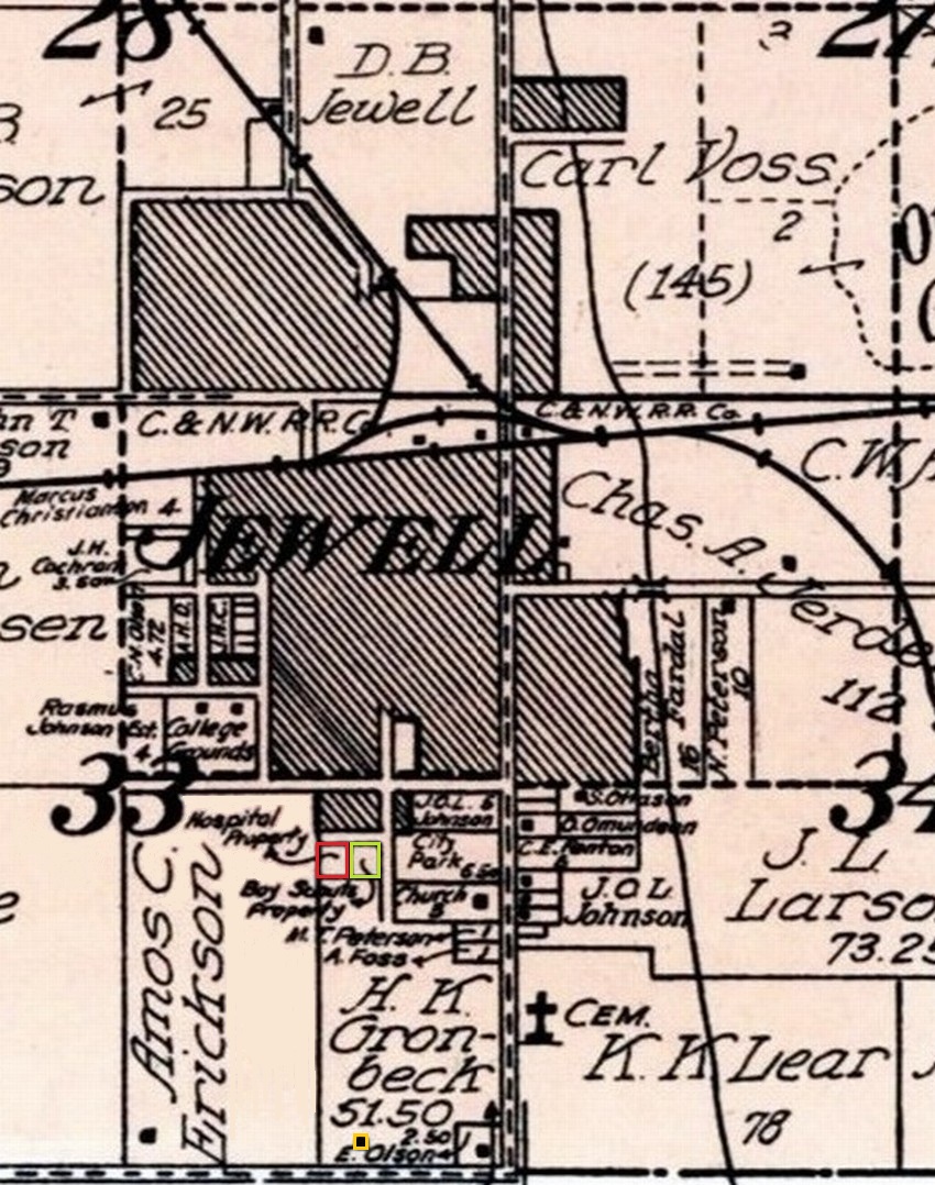
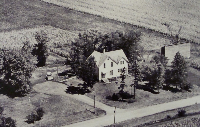
The farmstead partly seen at the bottom center of the
above image is the former Gronbech Farm.
Mr. Herman K. Gronbech was the farmer who in the early
1990s sold the northern portions of his land so Jewell
would have more land (in 1916) for the city park and
areas intended for the Scouthouse and a hospital (now the pool).
The 1918 Map seen next shows the farm and land sold
to the nearby town of Jewell.
Learn more
about the purchase of much of the Gronbech farm.
The former Gronbech farmstead (today in the Jewell corporate limits) is seen in this next aerial view from the 1960s.
The next two images show US Highway 69 and the area east.
A portion of Goose Lake (also known as Anderson Lake) can be seen at right.
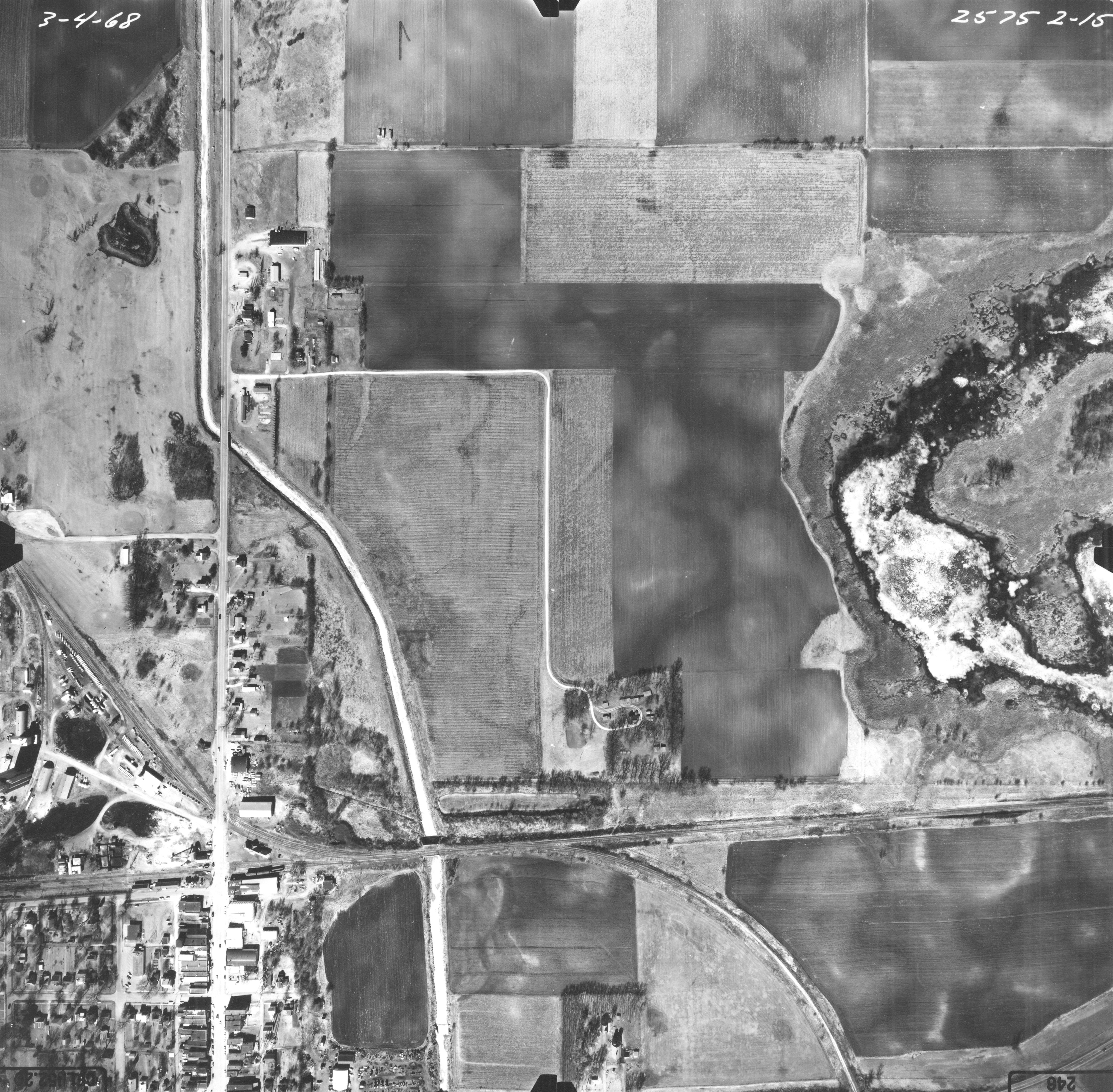
(You may click to enlarge these images.)
There is a significant overlapping area in the
images above and below this text.
The reservoir (also known as the res) which
held water once needed by steam locomotives is seen
surrounded by trees just north of the tracks.
The bright white curved line seen in three of these
images is not a road or highway,
but is the Cairo Lake (Mud Lake)
dredge ditch.